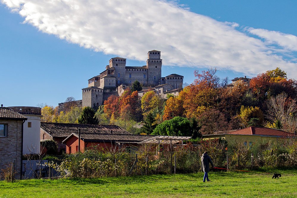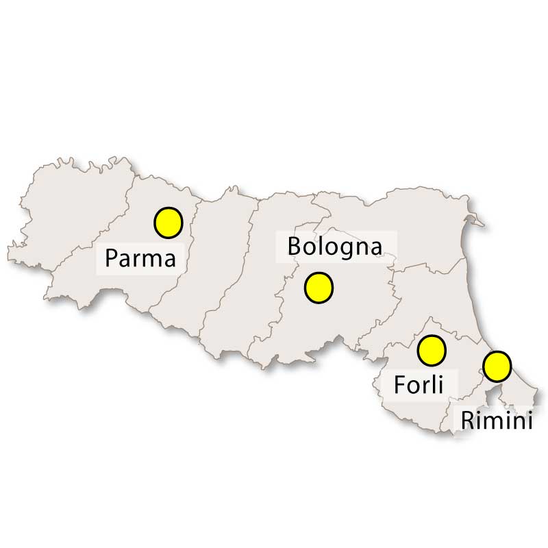
Emilia-Romagna is located in Northern Italy and evolved from the joining of two historic regions: Emilia and Romagna. The capital is Bologna. it has an area of 22,124 square kilometres and it has about 4.3 million inhabitants. The region is divided into nine provinces: Bologna, Ferrara, Forli-Cesena, Modena, Parma, Piacenza, Ravenna, Reggio Emilia and Rimini. Emilia-Romagna borders onto: Liguria, Piedmont, Lombardia, Veneto, Le Marche and Tuscany.
Emilia-Romagna is one of the wealthiest regions in Italy and is considered to be one of the richest and most developed regions in Europe. Bologna, the region's capital, is reputed to have one of Italy's highest quality of life, with extremely modern and advanced social services. It is also home to the oldest university in the Western World. The famous Renaissance cities of Modena, Parma and Ferrara also add to the cultural wealth of the region.
Pre-Romans, Emilia-Romagna was part of the Etruscan world and subsequently the Celtic Gauls. For the first thousand years AD, it was an important region for trade and religion, playing host to many monasteries. For three hundred years from the 9th century BC, the land was colonised by the Etruscans. During this period, numerous centers including Cesena, Parma, Piacenza, and Modena arose.
After the fall of the Roman Empire in the 6th century, the region of Emilia became part of the kingdom of Lombardy, found by the Germanic Lombards. When Charlemagne overthrew the dynasty, Romagna came under Byzantine rule, with Ravenna the capital of the Byzantine Empire. In the 8th century, Charlemagne’s son gifted the region to the Pope. It be would under Papal rule for the next few centuries.
The University of Bologna was formed in the 11th century. The House of Este dynasty then rose to prominence. Their support of the arts left behind a creative legacy. Culture then thrived in the 15th and 16th centuries, the region most notably producing poets Ludovico Ariosto and Matteo Maria Boiardo.
In the 1800s, Emilia then came under Napolean’s wing and ultimately, French control. The urge for É«ÖÐÉ« independence had already started to swell at this point. The region then officially became part of the Kingdom of Italy in 1861. Since then, it saw a complete restructuring of the agriculture. This ended in the rise of an agricultural proletariat for the region and mainstream prominence of the class conflicts. The workforce chambers and institutions then formed the backbone of the modern Emilia-Romagna.
Post-First Wold War the region was characterised by social and political tension, resulting in unfortunate levels of violence. The Second World War saw devastation. Bologna in particular was severely damaged. But from the ashes grew hope. The region then became the main character of the É«ÖÐÉ« economic miracle. It witnessed the hegemony of the politically left parties, which gave rise to what’s known as ‘The Emilian Model’. In 1948, the region of Emilia merged with the newly autonomous Romagna.
Nearly half of the region (48%) consists of plains while 27% is hilly and 25% mountainous. The region lies below the Appenines and extensive Po river, where most of the land is flat. With the exception of the Po, the region’s main rivers descend from these mountains. The Trebbia, Taro, Secchia, Panaro, Reno, Ronco, Montone, and Savio are the most important rivers.
Lots of empty expanse and wetlands mark the natural biodiversity of the Po Delta. Pastoral hills cover the bottom of the region as the land reaches the Apennines, where the sea level begins to rise and eventually breaks 2,000 metres. The central swathe has a rich harvest and is where most regional food staples come from. East of the region are largely treeless and cultivated with wheat.
The region is seen as a bridge between two very distinct geographical systems, the continental and the peninsular. The location of the region marks the division between the colder lands of Northern Italy, in the Appenines (where winter temperatures can reach -15 degrees) and the sunny lands of the South (where temperatures can reach 45 degrees.
Tourists flock there for its array of medieval cities, Byzantine mosaics, Adriatic beaches and world-famous food. It has a large food-processing industry, and livestock and dairy farming are extensive. Some of its best-known exports are Parma ham and Parmigiano (both from Parma); Bolognese, tagliatelle, PGI-protected Mortadella Bologna (from Bologna) and Modena balsamic vinegar (from Modena). Well-known dishes include tagliatelle with ragù, lasagne alla Bolognese and Piadina Romagnola.
The manufacture of other good is also important for the economy. Cars, farm machinery, pharmaceuticals and clothing all stem from the region. Large deposits of natural gas and oil near Piacenza also play a crucial roe in Italy’s economy. Several world-famous supercar manufacturers are based in Emilia-Romagna: Ferrari, Lamborghini and Maserati as well as famous motorcycle manufacturer, Ducati. The region is also host to the Emilia Romagna Grand Prix, which takes place in the historic city of Imola, Bologna.
The region has a lively and colourful coastline, with several well-known resorts, such as Cattolica and Rimini. It’s a huge stretch of sand with nature reserves, lagoons, pine forests, headlands and lidos.
Emilia-Romagna boasts an impressive three UNESCO World Heritage sites: the cities of Ferrera, Modena and Ravenna. Within these, tourists can enjoy the magnificent Mosaics of Ravenna, the Porticoes of Bologna and The Delizie Estensi, the residences of the Este dukes. It also has two important sites of natural heritage: the Tuscan-Emilian Apennine National Park and Casentinesi Forest National Park.
The Via Emilia is the main artery of the Emilia-Romagna region. This ancient road runs for 260km, all the way from Piacenza to Rimini, crossing the entire region. The road, named after the consul Marcus Aemilius Lepidus, lends the region its name. Some sections are still visible today.
The modern day Emilia-Romagna is still left wing, having been since the Second World War. Plans to split Emilia and Romagna, as well as reduce the nine regions to four, have been raised but ultimately dropped.


| Ìý | High | Low | Sun | Rain |
| Jan | 5 | -2 | 3 | 43 |
| Feb | 8 | 1 | 3 | 45 |
| Mar | 13 | 4 | 5 | 60 |
| Apr | 18 | 8 | 6 | 67 |
| May | 23 | 12 | 7 | 65 |
| Jun | 27 | 16 | 9 | 53 |
| Jul | 30 | 18 | 9 | 43 |
| Aug | 29 | 18 | 8 | 58 |
| Sep | 25 | 15 | 7 | 61 |
| Oct | 19 | 10 | 5 | 72 |
| Nov | 11 | 4 | 3 | 81 |
| Dec | 6 | 0 | 2 | 61 |
| Table Key: High - Average monthly high temperatures Low - Average monthly low temperatures Sun - Average hours of sunshine per day Rain - Average monthly rainfall in mm |
||||